Categories
Uncategorized

An ancient guide

ancient pilgrim stone at stream ford

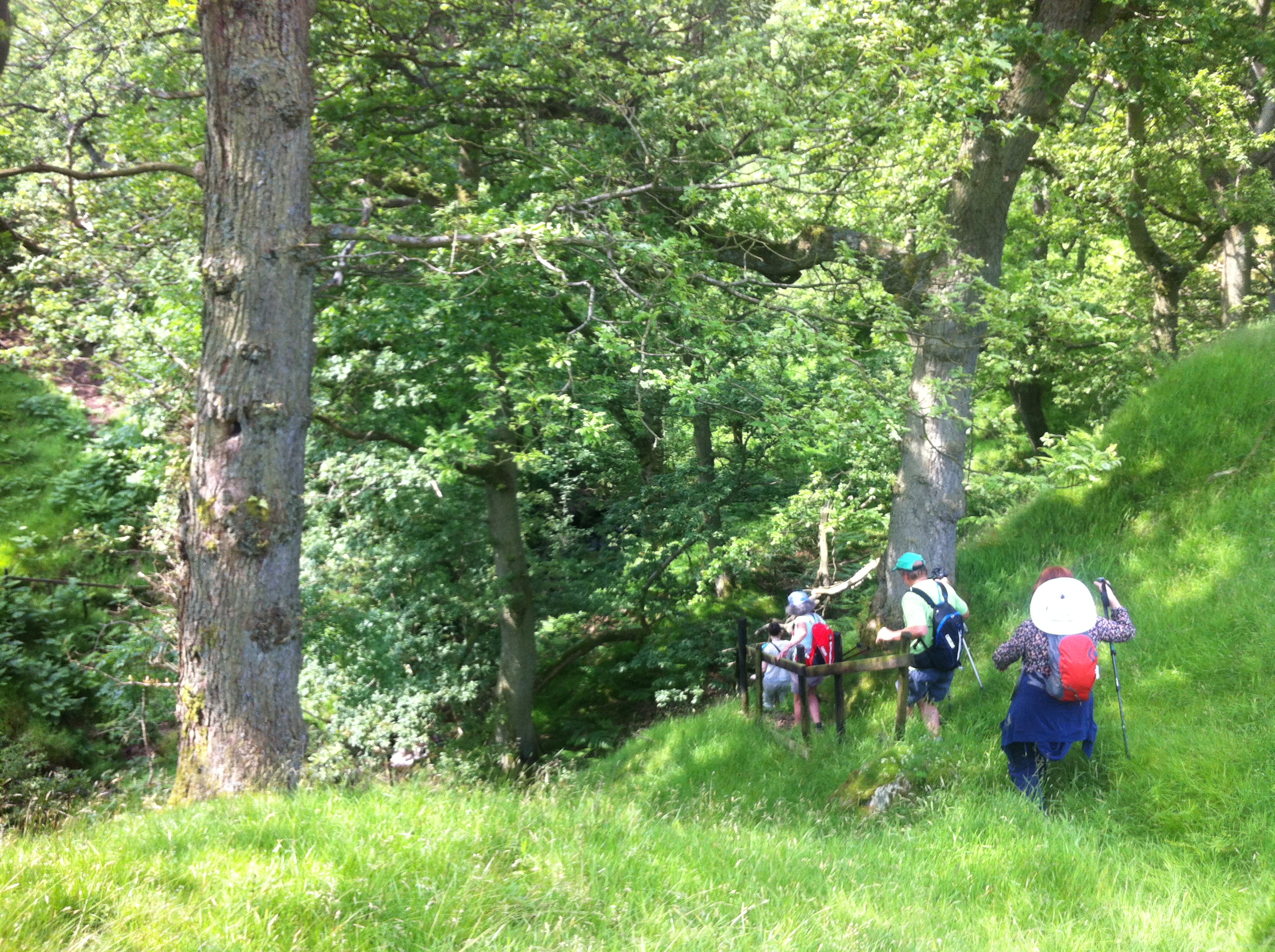
Images arise of our way through this lost wood: grainy scenes of leaf and thorn, rock and shadows dappled with mid-day sunlight, the colours everywhere we look overly-rich and lush, the earth moist in our nostrils, the movements of my fellow pilgrims as we descend through the understory of the wood truncated and choppy, like characters in one of those films already ancient by the time it was shown us in high school. The six of us step carefully under a few large oaks casting their great shadows, after which are clearings floored by dead leaves under ash and alder, some of the saplings garlanded with bushes of holly of an impossibly deep green, leaves sharp, glinting like glossy plastic. Where there is shade, there are deep ferns. Most reach our waists although some reach up into blossoms at nearly head-height. At the bottom of the valley the ferns clear and the stream, having changed direction long before we did, meets us once more, this time running south through the ferns and high grasses. We do not know where we should be going, but there is a wooden step-bridge here also, and this time, something else. “Look, look!” shouts Sara, leaning in and pointing in excitement at something half-hidden in the grass on the far side of the planking. It is a boulder, placed on its end so that comes up to her waist, moss-covered, and with paint-like blotches of thick white here and there across its face. The moss covers but doesn’t quite conceal cut marks. “A cross!” Sara traces the ancient lines so we can see, “it’s a pilgrim marker. We must be on the right path.”

There in the upper left quadrant of the standing stone is the cross, cut clear and deep. It’s a sign from others, medieval pilgrims perhaps, or travelers across the moors from centuries past. There’s nothing like a sign to bring speed to our step. The others have already started up the slope. I hesitate. The stone looks old, and there are other cuts there, less distinct. On the top of the boulder cup-marks, and to the right of the cross another line, and then another below it, like a peaked hat or a bird in flight. Britain is full of carved stones, and a medieval pilgrim cross, old as it is, would be a relative newcomer to the long history of rock art. Cup markings and rings can date from the Neolithic or the Bronze Ages.

The others have moved quickly through the deep ferns. This time there is no hesitation. We may not know where the trail is, but we do know the top of the hill. I’m trailing the group, who shout down their encouragement to move on. The moors await us.


Categories
Uncategorized

Stiles and Kissing Gates

down to the river fording

Some fences mark a human boundary, some a physical frontier. This fence was one of the latter. Instead of keeping apart two rocky fields that are otherwise indistinguishable, or two similar flocks of sheep, the fence at the lower field boundary marked a sharp dividing line between field and forest, between hillside and deep valley, and between sunlight and shadow.

Our group of six crossed the stile, the first across uncharacteristically waiting on the other side of the fence until we were all together. By unspoken consent joviality had been replaced by solidarity. The overgrown path and lack of certainty made us pack animals.

For someone who grows up in the Canadian west, crossing a fence inevitably means grasping strands of barbed wire in hand, stretching the space between the lowest and middle strands as wide as possible, and then squatting and pivoting your back end while you lift a foot and squeeze through, back straight and derriere high, in hopes that no piece of shirt or pants will catch a barb and tear. There are very few stiles in Canada because there are very few public walking paths on private land. In England the history of the stile and the history of the citizen fight to keep public paths open are one and the same. Most UK stiles – certainly the ones we crossed – are built by property owners under legal compulsion.

Most stiles are ingenious in their simplicity. Usually, they consist of a post and a step on both sides of a fence: one step up, then hold the pole for support, swing one leg over to the step on the other side, then the other leg, and Bob’s your uncle. With a stile there’s no need to remember to close a gate, and there’s never any concern about a jammed lock or unworkable mechanism. The livestock have no chance to get out and repairs consist only of replacing a board every few years. The wooden step stile may be primitive, but it’s hard to improve on a model of such basic efficiency.

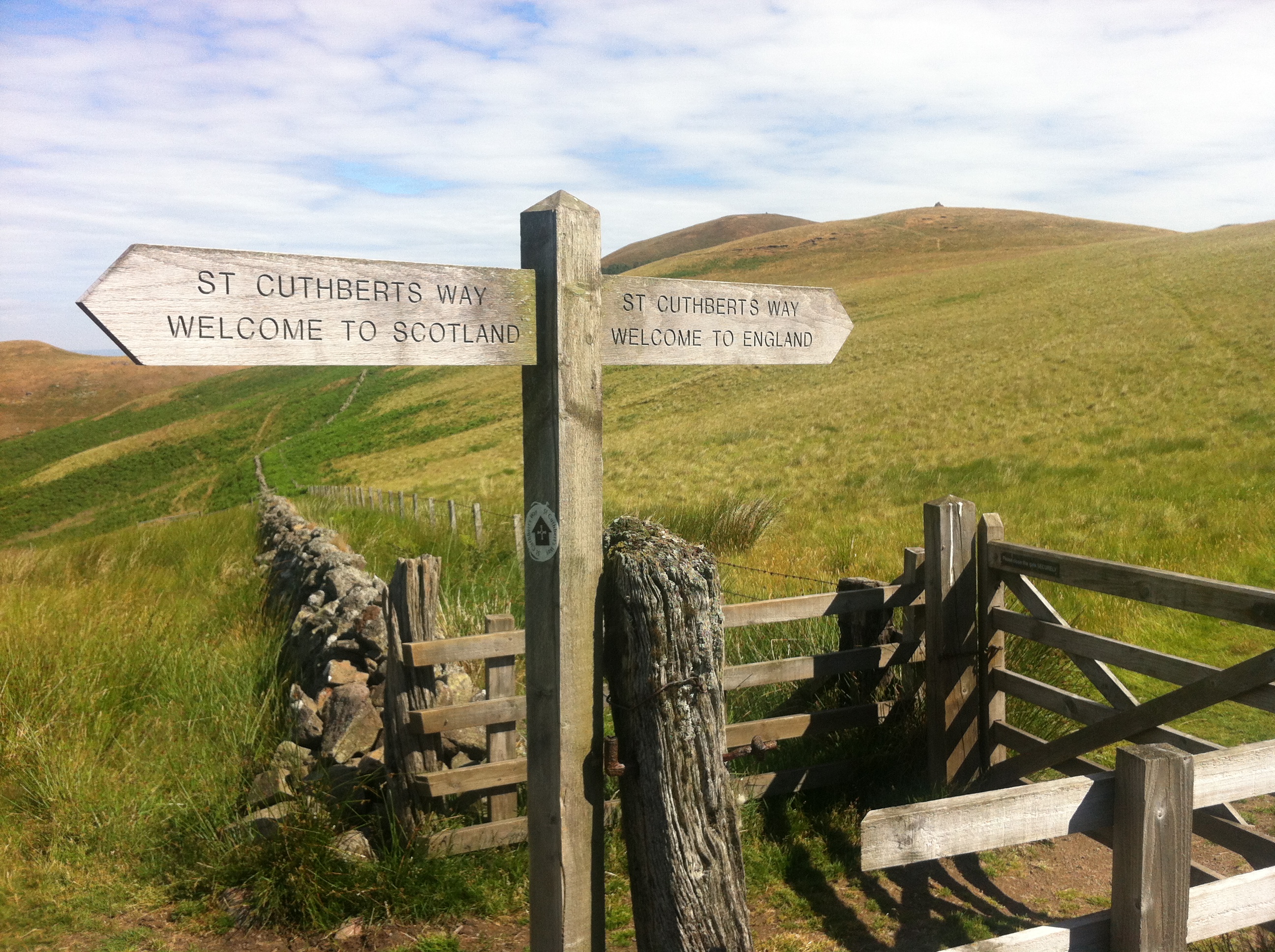
Perhaps my favourite gate is the one on St. Cuthbert’s Way, at the dry-stone fence, edged by thistle and grass, that marks the border between England and Scotland. It was a bit lonely a location, on the top of a knoll and across a valley from a Bronze Age ring fort, but the day I reached it I felt a sense of occasion crossing, and missed having someone there to share it with. There should have been a pub, as there had been, and a good one, back in Kirk Yetholm. Instead there were cattle, and stinging nettle, and burnt-yellow grass, so I kept on.

the border

Another common form of fence crossing in the UK is what is known as the ‘kissing gate’, so called because there is a gate in the fence that swings free between two fixed posts, just to the point of being able to touch, or ‘kiss’ each post. If you were looking at a kissing gate from above, you would see a walker step to the gate, push it against the far post, step into the small space at the open end of the “vee”, then push the gate back against the post just crossed, and exit through the cleared path on the other side. The point of a kissing gate is that a person can step into and through the pocket that is protected from the swing. But any four-legged creature cannot.

For the walker, the most reassuring thing about a stile or a kissing gate is that it’s proof, physical evidence in wood and sometimes steel that this is, if not the path, at least a path intended for walkers. From where it crossed the fence into forest, the Northdale trail we had decided to take led sharply downhill. As our eyes adjusted to the gloom we stepped carefully over exposed roots and clean river stones that skittered and clattered and slid underfoot. There was a close, fragrant feel to the air. I could feel the suddenly coolness on my skin; despite the trees there was a slight breeze from the north; the valley acting as a funnel for air from the high moor country, perhaps from whatever springs fed the stream we could hear below us.

For a path we had chosen because of a lack of options and not for any particular markings, this one at first seemed quite promising. When we had walked only a short distance we saw that were stairs cut into the earth and banked by wood, and because of the steep descent someone had installed first a wooden railing, then a rope alongside the path at waist height. Just when we were feeling heartened the stairs split, each path descending a different direction. It was the classic dilemma: left or right? We chose left, descending another two sets of earthen stairs to a wooden bridge that couldn’t have been more than a few decades old. The stream would likely have been passable without the bridge by jumping from boulder to boulder across the pools and alternating rapids, but the cool forest air and shadow meant that most of the rock surface was slickly moss-covered. Boots would not have held. Someone would have gone in, or bruised or snapped a bone.

On the far side of the bridge was an ascent as steep as the bank we had just come down. After a few yards of climbing, the path disappeared under high ferns. We slowed, wading through the green, unwilling to risk falling into a hole, or worse, down some unseen rock face. For a few minutes we slowly tested the brush for any hint of trail, but it was clear no one had been through in some time. Whatever path was once there had disappeared. We turned back, first descending to the bridge, then back up again to the forest junction, somewhat anxious. Now there was only one option.


Categories
Uncategorized

Waiting for a Sign

while finding our way

Walking a partially sign-posted pilgrimage trail is a bit like living out Kierkegaard’s leap of faith in miniature, a hundred times a day. While walking the trail, there is a process that you go through between signs, a crisis of faith and doubt. When the arrow or the sign is first spotted, you feel a natural sense of relief. You launch yourself out and away from the waymarker, your feet sturdy and your mind at ease, but only for a moment. Soon enough comes a fence corner, a split in the path, a field empty of indications or a stile that is unmarked, and you must decide: is it that you have missed a marker somewhere, that the marker was never placed where it could have been useful, or was perhaps lost or knocked down (over the years I have found many markers in ditches, knocked down by sheep or cattle, or behind overgrown bushes), or is it that you have somehow unwittingly strayed from the path and should retrace your steps?

This is the moment – or rather, one of the many moments in a pilgrim walker’s day – of decision. Paths are rarely uniformly sign-posted. From the point on the path where you hesitate, it could well be that the anticipated marker is just over the horizon; at the next junction or field corner. Or it could be that somewhere, a hundred or two hundred paces back you have missed a sign or a deviance in the trail that you should have caught. The slowness of walking, which is normally, I would argue, one of its advantages, begins to work against you. Any decision, whether to push forward or to backtrack, is an investment both in time and in precious energy. In a ten-hour walk on a secluded trail, too many bad investments can mean the difference between success and unpleasantness, discomfort and perhaps even in some rare cases, disaster.

Modern technology, and especially the nearly ubiquitous smart phone with its built-in GPS location systems, would seem to have made the pilgrim’s Kierkegaardian dilemma obsolete. Even if a sign-post is missing, the map function of a phone should be able to show the pilgrim where he or she is, at least closely enough to avoid much more than a few fields’ length of detour. Unfortunately (or fortunately, depending upon one’s view of such things) there was no mobile phone coverage in the Rosedale valley. We were on our own with terrain and map.

We passed a farm that we thought might have been Northdale Farm, but was not. Now we knew we were seriously off the trail. We looked at the maps, but they made little sense. We talked, but never argued. Six cooks and still the stew was okay. The trail continued on through a field north of the house and barn and then petered out in the second field, turning into what seemed to be only an animal track. We spread out, all six looking in different directions uphill, and down. In the downhill far corner of the field closest to the wooded gully was a gate. It looked like there may have been a sign there; certainly there seemed to be a trail. We headed downhill.

There was no sign. Then again, there never had been any St Hilda signs per se. On the other side of the valley the earth rose up again to the heights of the moors. Our trail was on that other side. We knew that much at least, and that to get there we’d have to cross the valley. There was no sign, but there was a path. The woods were thick with underbrush, the trail overgrown. The sounds of water came from somewhere down below. We decided to risk it.

Categories
Uncategorized

Walk Past

There’s something about Lindisfarne, Norway and Ireland that connects all three in history, art, and memory. And faith. Cuthbert (634-687) was an Anglo-Saxon shepherd boy trained by Irish monks from Iona, who accepted the decision at Whitby to go with Roman customs, and whose remains were troubled by Viking raiders, whose Danish descendents in the Danelaw, later Northumbria, eventually honoured him as their patron saint. Life is indeed strange. Over thirteen centuries later, a descendent of Norwegians, I arrived by foot at the cave of St. Cuthbert, accompanied by my Northumbrian friends Chris and Clare, after having marveled at the intricacies of Viking art and archaeology in Celtic Dublin and walked through Norway’s St. Olaf Way, to pay my respects at one of the resting places of an Anglo-Saxon saint.

Mostly that morning I’d been worried about keeping up with Chris. His lanky frame and long legs, combined with a love of walking, an interest in history and an excitement for the path ahead, mean that he is a wonderful pilgrimage partner – when he doesn’t mind slowing just a bit. In any case we had to slow to find the place. The signs to Cuddy’s Cave, as it is sometimes known, were not all that clear. The property is managed by UK’s National Trust, but unlike some of the Trust’s other locations there is little infrastructure – just the sandstone rock formation, stairs cut into the rock on either side, some blackened soot on the cave wall from someone attempting a campfire, and the cave itself. Standing in the cave, it’s hard not to feel the weight of the rock overhead. Here, according to which report you believe, was where St Cuthbert actually lived for a short time as a hermit seeking even more isolation than Holy Island could provide, or where centuries after his passing the monks of Lindisfarne hid out from the Vikings with the coffin of the unfortunately mobile saint. Or both.

Both Chris and I are in our 50s. When he was in his early 50s, St. Cuthbert realized that death would soon be on him, and left his post as Bishop and Prior of the active monastery at Lindisfarne/Holy Island to die in his hermit’s cell on Inner Farne Island. He left specific instructions that he did not want to be buried at the monastery because he did not want the monks to be bothered by all of the pilgrims he knew would come to his tomb. But his friends insisted and so that is where he was first laid to rest.

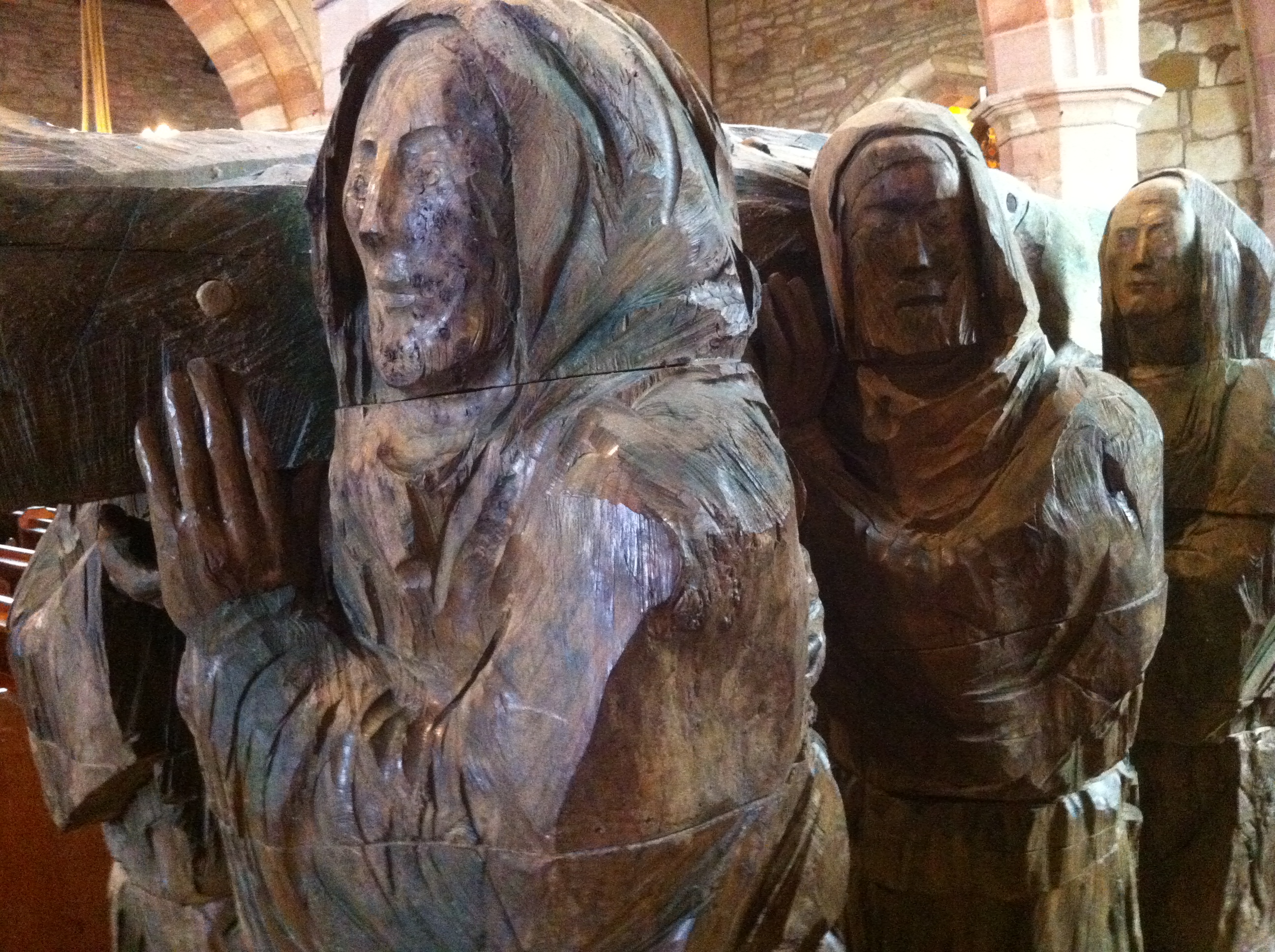
It was almost as if Cuthbert knew what would happen. Centuries later, the vikings raided rich Lindisfarne and laid it to waste. While the sea marauders were not interested in the saint’s spiritual blessings, they were very interested in the kinds of riches that typically adorned saints’ tombs. So the monks fled with the coffin of the saint, and wandered the countryside for seven years before eventually being led by a dun cow to the site of what became Durham cathedral.

Caves are places of shelter, life and death, despair and fear, and hope. The ferns along the path nodded at the lightest touch of a warm wind, and cicadas started up here and there in the trees to accompany our bright and lazy afternoon. As we shared a cup of tea I tried to imagine Cuthbert right there, where our packs were set against the sandstone. An ancient saint, rocks more ancient still.

In his early 50s. The nature of shrines is that we all carry something not only to, but also past such a place. I hadn’t quite finished my tea but Chris was pacing. I got up, brushing the crumbs of cake off my chest. What do you think, I asked him? Can we still make it before sunset?

carrying St Cuthbert statue


Categories
Uncategorized

From Old Montreal to Kahnawake: a 34-km pilgrimage to combat ignorance

A group of Theological Studies students at Concordia bridge cultural — and physical — divides

Posted on June 18, 2014
|
By: Matthew Anderson
Pilgrimage

Photos by Matthew Anderson


Last weekend Matthew Anderson, an assistant professor in Concordia’s Department of Theological Studies and the Loyola College for Diversity and Sustainability, and Sara Terreault, a lecturer in the Department of Theological Studies, led a group of students on a walking pilgrimage from Old Montreal to the Kahnawake Mohawk Territory.

From Saturday through Monday, they toured churches and First Nations institutions, learning about the people and the cultures they represent. Anderson compiled this account.

Plotting a 34-kilometre walking route between Old Montreal and the Kahnawake Mohawk Territory was difficult. But the hardest part turned out to be the last few kilometres.

Sara Terreault, a lecturer in Theological Studies, and I were temporarily stymied at city hall in Sainte-Catherine, a city near Kahnawake on Montreal’s South Shore.

“Oh, no, you can’t walk to Kahnawake from here unless the police stop traffic and you use the highway,” a clerk said. “I’ve lived here for 30 years, and I can tell you that it’s just not possible.”

Only a couple of minutes later, we discovered a service road footpath connecting the communities along the river. The problem is clearly not impassible terrain, but something else. Maps of the town end at the border and show a blank space to the west, where Kahnawake lies. When there is a blockade or a political crisis, this benign ignorance on the part of many non-Indigenous Montrealers can turn into outright suspicion or hostility, as clearly happened during the so-called Oka Crisis of 1990.

What’s the solution to such a conundrum? Part of it may begin with simply putting one foot in front of the other.

Pilgrimage

Students move between two destinations — and two cultural realities.

In a study I’m presenting in July at the Sacred Journeys conference at Mansfield College, Oxford, I propose that the dynamics of a trek offer a unique way to bridge cultural differences. Our research shows that walking combats ignorance of the cultural “other” not only in the shared experience of the journey, but also by allowing us to feel in our own bodies the distance from — and proximity to — these supposedly foreign places.

This is an experience that travelling by motor vehicle just doesn’t offer.

Taking steps to combat ignorance

This summer, Terreault is teaching a course on pilgrimages in the Department of Theological Studies. Along with me, she organized the 34-kilometre walk from Old Montreal and Kahnawake, which we undertook this past weekend.

To test how walking pilgrimages change the cultural suppositions of those who undertake them, she required her students to critically engage with pilgrimage theories during their trek between the historic destinations.

Notre-Dame-de-Bon-Secours Chapel

Participants tour Old Montreal’s Notre-Dame-de-Bon-Secours Chapel, once a popular site for Christian pilgrims.

The walk began on Saturday morning, with a tour of Old Montreal’s iconic 17th-century Notre-Dame-de-Bon-Secours Chapel, a structure built at the behest of St. Marguerite Bourgeoys that served as a pilgrimage site for the first Christian inhabitants of what was then called Ville-Marie.

From there, we walked the 23 or so kilometres to Sainte-Catherine, where we stayed in the basement of Église Sainte-Catherine d’Alexandrie. Early the next morning, we began the roughly 10-kilometre trek to Kahnawake.

While there, we visited the shrine of Kateri Tekakwitha, who became the first Indigenous North American saint with her canonization in 2012. We learned more about Tekakwitha from Orenda Boucher (BA 09, MA 13), who is working on a PhD thesis on Mohawk spiritual expressions.

Later, we toured the Kahnawake Cultural Centre with Tom Deer, its cultural liaison officer, before we ended our time in the territory with a visit to the Kahnawake Longhouse, a place for traditional religious expression. We also had the privilege of spending some time with Kenneth Deer, a Kahnawake journalist and educator who is involved with the United Nations Permanent Forum on Indigenous Issues.

Our pilgrimage concluded on Monday with our walk back to Montreal. Terreault was moved by the entire weekend.

“It’s humbling as well as instructive to see how warmly we were welcomed throughout our journey,” she said. “Communitas is a technical term used in pilgrimage studies that refers to the spontaneous emergence of fellow-feeling among people journeying together, regardless of social or other differences. There was certainly a sense of that about our entire trip.”

Ultimately, the voyage we undertook was not so much to a destination as between two cultural self-understandings and the physical spaces that exemplify them. It’s important to note that the walk was part of Concordia’s ongoing mandate of public outreach.

On our journey, we crossed densely urban, suburban and industrial zones, as well as parks and recreational areas, rediscovering parts of what was once an important historical Montreal trail. But as much as we were retracing the past, our eyes were definitely on this route’s future. Our political leaders, including those of the First Nations communities, are asking us to learn from each other.

Walking is a singularly powerful way to begin to do exactly that.

article from Concordia NOW, at http://www.concordia.ca/cunews/main/stories/2014/06/18/from-old-montrealtokahnawakea34kmpilgrimagetocombatignorance.html

Categories
Uncategorized

Twenty Minute Liminality


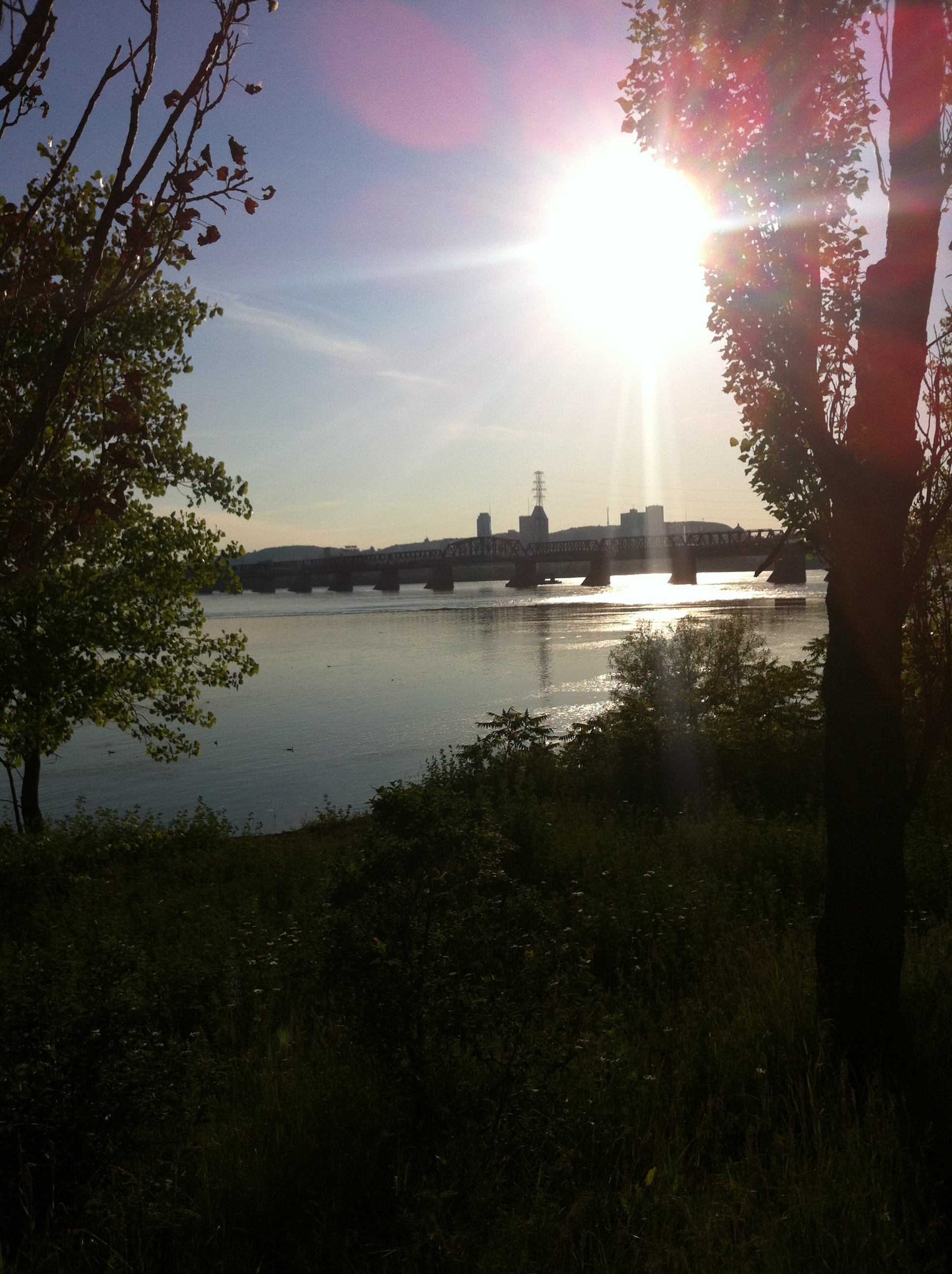
Bridge from SeawaySince it wasn’t rush hour and the span over the St-Lawrence was clear, it took only twenty minutes to drive from my home in Verdun to where the steelwork and concrete delivered the little rent-by-the-hour Toyota containing my friend Sara and me into the Mohawk territory of Kahnawake (Kahnawà:ke). I’ve always found there to be something almost harsh about the Mercier Bridge. Despite being of similar construction it has none of the 19th century charm of the Victoria (a bridge my children used to call the “singing bridge” when they were little, for the hum of the tires on the steel tracks slung along its sides). Nor does the Mercier attempt the modernist concrete vision that first inspired and then doomed the grandly arching Champlain, finished in 1967 and already on life support. Where the Jacques Cartier Bridge meanders genteelly over roller coasters and parks, the Mercier seems more grimly pedestrian, even though actual pedestrians would be risking their lives to walk it.

Maybe it’s the way one is forced to drive the Montreal approach to the Mercier, encased in a graffiti-covered cement chute that twists and turns through barely glimpsed walls of duplexes until the roadway finally shoots you up and onto the steel. It’s really only as you near the bridge’s end that you realize how high you’ve come. And then, just as the Seaway glitters below you, you drop down the exit ramp to the erroneously named “south shore”, the car’s shocks pinging at potholes. Suddenly you’re in a land you didn’t realize was there, a strip of gas stations, restaurants, smoke shops and road-side businesses with signs in a language that seems to have too many consonants, apostrophes and syllables to make sense. This is not your land, you think. And you’re right.

The Mercier Bridge’s greatest shortcoming might be that, on a good day, it delivers you too quickly from one world to the next. From the thick stone walls of the centuries-old Roman Catholic mission among the Iroquois, through the Mohawk steel workers who were first trained on the bridge spans and went to American cities for work, through Indian residential schools and the riots and blockades and soldiers and warriors of the late summer and fall of 1990, there are stories to be told about every foot of the transition between shore-lines. When traffic is light the stories flit by like the shadows between girders, far too quickly even to be heard, much less really heard, which is to say, to be felt and understood.

In June Sara and I will be leading a group of walking pilgrims from Old Montreal to Kahnawake as part of the pilgrimage class we’ve developed at the Department of Theological Studies, Concordia University. Each year the students have had to walk a pilgrimage. While in the past we’ve focused on European routes, this year we’re sticking closer to home. In June we will walk the 30 km or so one-way route together. Although we are starting in the Old Port it won’t be a pilgrimage to Kahnawake (although such a pilgrimage does exist, centred on the shrine of the Mohawk Saint Kateri). Instead we hope our June walk will be an experiencing of the full distance – cultural, temporal, linguistic, historical, and spiritual – between two poles: Old Montreal, one of the hearts of Champlain’s dream of French settlement in this part of North America, now a gentrified example of Quebecois North American culture, and Kahnawake, a territory of the Mohawk, part of the historic Haudenosaunee Confederacy. Each end of this walk has its own understandings of, and traditions around, journey. We hope that by taking our time along the distance between those understandings and experiences of mobility this summer, the stories will unfold at a pace we can hear as well.

This morning when Sara and I arrived by car in Kahnawake, we realized fairly quickly that our maps were not going to be of much use. There were no street signs to be found, anywhere in the village. “Why do you need street signs?” someone said to us when we asked, with a gentle lifting of the shoulders and the trace of a smile. “Everyone who needs to know where they’re going already knows how to get there.”

This summer we hope that we too will learn, together and footfall by footfall, where we are going, and how to get there.

The heart of Kahnawake

Categories
Uncategorized

Winter Walking

img_3002.jpg

I love a public road: few sights there are

That please me more – such object has had power

O’er my imagination since the dawn

Of childhood, when its disappearing line

Seen daily afar off, on one bare steep

Beyond the limits which my feet had trod,

Was like a guide into eternity,

At least to things unknown and without bound.

                                                                                                            Wordsworth


The snow is falling. Ice has formed on the sidewalks and walking is becoming, if not impossible, at least treacherous. My 4 km path from home to office has been transformed into an obstacle course. Not so much harder, I guess, than some of the summer’s more difficult wanderings, but requiring much sturdier dress. And even in its warmth, the city was harsher than Norway and Scotland’s hedgerows and mountain trails. There are no wild flowers along the way, no trout rising in any stream through Verdun, no herons kicking into the air to greet my passing. Now there are gusts of needle-sharp air around the frozen concrete corners of walk-ups. There is the way the wind plays a winter song on the wires, calling the pigeons out to find the bread crumbs someone left on the snow. And there is N-, the homeless man on the bench he stubbornly, nonsensically prefers to a warm bed, his nose dripping even as he speaks to me in the most reasonable, cultured, and educated of tones about his degree in English literature. “I can’t leave,” he tells me, “they asked me to be here in this place when they come, which should be any day now.” He shifts his legs and adjusts the plastic bags around him. I look at his boots. Such is mental illness. But then, it was a kind of rootlessness I aspired to not many months ago. I buy him snow pants and worry about him on nights like last night, when it drops to 28 below. I think of my sons and know he is someone’s. Calling the police is an option.

There is garbage in the gutter, the smell of oil and tomato sauce unexpectedly tinging the vacuum of air behind the pizzeria, the hiss of the plastic Frosty the Snowman who lifts out of his inner tube once every thirty seconds as the air pump builds him again and again to greet a street that is empty except for me. Later a car rolls slowly by, a foreign creature, windows shadowed, the sound of its tires compressing the snow loud in my ears, muffled bass beating like a heart buried deep within.

Peregrination seems far away from this winter world. Against the cold and dark of the city, life has settled into whatever warm niches it can find, leaving little above the surface. But there is life nevertheless. Different eyes are needed for walking this way, different rhythms to keep from falling on this pilgrim route. There is a different loneliness and a different cost.  In my doorway I take off my gloves and the back of my hands is red and raw, the skin threatening to break open from dryness. The only hand cream I can find stings.

 A Verdun Christmas 2012


Categories
Uncategorized

The Likes of You Walking

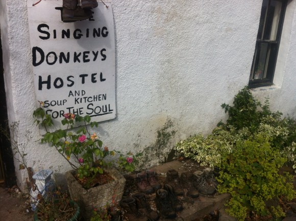
Singing Donkeys Hostel Kirk Yetholm

As I leave the village of Kirk Yetholm, striding up toward the bare yellow hills of the Scottish Borders, I walk past a sign announcing The Singing Donkeys Hostel and Soup Kitchen for the Soul. It is hand-drawn. I stop despite myself, and think about singing donkeys, trying to remember if I’ve heard anything overnight that might be a braying animal. All I can visualize are the Bremen Town musicians, and I’m pretty sure they didn’t mean that. The sign, and the motley collection of boots underneath, conjure other images between memory and imagination, that I realize are probably not accurate even as they keep floating to mind: a young man in Rasta hat and beard, stirring soup in a communal kitchen, long and lazy afternoons in the sunlight with indistinct plans, someone playing guitar in another room and the sweet-sour tang of pot drifting in an open window, the feel of sex in the air, dream-catchers and crystals and Buddha prayer corners. A part of me wants to knock on the door, tempted by whatever “soup kitchen for the soul” might mean. But it’s too early in the day to begin detours, real or metaphysical. I wasn’t a hippy even when there were hippies. Although my bed at the Borders Hotel was too soft and the beer too tempting, it felt more like home. I take a photo and move on.

Months later, back in Canada, I read in a book about the St. Cuthbert trail that the hostel in Kirk Yetholm was, centuries ago, built as a schoolhouse for gypsy children.

As I’ve discovered on pilgrimage, morning inevitably means climbing. It’s 8 am and the sun is already feeling just a touch too warm for what I had only ten minutes before decided would be perfect wear. Upset with myself, I strip off a layer of merino wool and add it to the weight in my sack. This portion of the trail coincides with the Pennine Way. Probably because I’ve read accounts from those who’ve walked the Pennines, and every story stresses how difficult the path is, I keep expecting to be overtaken by long-legged, weathered, grim-eyed hikers, a different, hardier species, even though I’ve been averaging 25 km a day myself. There is a Pennine Hikers’ Inn, to my surprise looking much more luxurious than my Borders Hotel, and then a corner marked, mysteriously, Halfwayhouse. Half-way to where, I wonder? And where is the house? There are sheep everywhere, unfenced and curious, but no sign of human life. And oddly enough, no walkers, even though this is supposed to be one of the busier parts of the route.

Something happens in the mornings when you’ve been walking day after day: you begin to get eager – almost impatient – for the rhythm that sets itself up in your body after a kilometer or so on the trail. It’s something that stays on, most evenings, even when you’ve dropped your pack for the night and had your solitary meal, when you’re lying in bed trying to remember what day it is and why you were so stressed back home. Maybe it’s a rhythm of breath, or of the feet, or of both. There’s something in it of feeling your lungs tighten under the pressure of taking ever-larger breaths to handle the climb, or noticing the increase in heart-rate, knowing without any doubt that it will drop again as soon as you’ve taken a moment to rest. I’ve read that happiness is doing what you’re designed to do. Humans are designed to walk.

It’s probably that happiness that leads me up the first big hill of the morning, an imposing bare challenge of a knoll planted right in front of the road. The hill is called Green Humbleton on the map, had I been smart enough to look at my map. It’s only 268 meters, but when what I’d thought was the trail becomes indecisive and finally peters out about three-quarters of the way up, I assume that the cairn of stones I can sort-of see is my next marker. The way goes neither left nor right, and so neither do I. The top quarter of the hill is steep, so steep that at times I’m forced to scramble on all fours, burrs and seed spears digging into my soft palms. Bottle flies sit in black swirling columns of air that I pass through, forcing myself to breathe in through my nose so as not to inhale too many insects at one go. Horseflies discover the exposed flesh of my arms and legs, wet with sweat and red with exertion; I swat as best I can, but each swivel, because of the weight on my back, threatens to tip me over. When finally I stand at the summit of the hill, the warm gusts of wind are a blessing.

But there is no trail down. I sit for a second to catch my breath and scan the hills for the trail from which so clearly I’ve strayed, but sitting is just an invitation for more horseflies, and I’m bitten twice. So I stand again, and begin the descent. I’m a bit jittery, the way the weight of the pack jolts with each footfall, and with a mild curse at myself for almost making a mistake even worse, I slow down. This would be the way to lock a knee, or step in a hole. Eventually, I spot a sign to my right. The path has wisely sidestepped the hill. I’m happy to be on it again, even though it rewards my happiness by leading, honestly this time, straight up yet another rise.

In the morning, setting out, I’d asked an older woman where the path out of the village began. She’d looked at me in silence for a second, as if debating whether to answer, and then stretched out one arm, almost like a curse, to point at the hills. “That’ll be for the likes of you, walking,” she’d said. Then she smiled.

I remembered that when I reached a gate in a stone fence. There’s a sign. It reads, on one side “Welcome to Scotland” and on the other “Welcome to England”. I open the latch, and step through to another country.
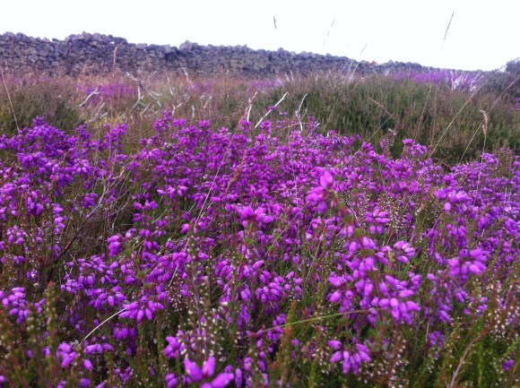
heather and wall
the border

Categories
Uncategorized

Kindness

the Tweed day one

“We’re here on this earth to be kind to others. What the others are here for I don’t know” (Auden)

Tuesday turns out much hotter than I’d thought: by midmorning I’m already out of water. The path has been one long riverbank meander, common sandpipers calling and flitting through the low branches, a lone grey heron loosing itself awkwardly from its perch as I passed, and a series of wooden steps with wire mesh tread, forever up and down, up and down over eroding dirt banks and muddy tributary creeks and cuts. Finally the path turns right. It climbs steeply uphill through tall grass and buzzing wildflowers that make me dizzy.

Sweating and out of breath, I follow the way-markings into the village of St. Boswell’s. At first I’m relieved. But no stores are open and the doors are shuttered against the day. There’s a Scottish flag on a pole in the middle of a field of overgrown weeds. My feet immediately dislike the sidewalk. They yearn for a return to the shade and the cushion of the forest floor, but I know this may be my one chance to replenish water. When I dig it out, the guidebook says to be sure to stop and look at the stained glass in the parish kirk. The church door resists a pull; like everything else in this town, it seems permanently locked. For a while I peer at what I think may be the glass through the dark windows, but I can’t tell if the colours I see are real or my imagination. This is my one chance to see the work of Liz Rowley, an artist I cared nothing for nor knew anything about until I’d opened my guide. Traveling is about glimpsing what we have just missed. For a while I sit on the low stone fence outside the church until a tall, slim man with a pack approaches. He must have been behind me on the country trail. He’s walking fast.

I say hello. He seems reluctant to break stride, but does. A walker. He introduces himself as Chris. We talk for a moment and for a few blocks I join him and try unsuccessfully to match the speed of his long legs. We come to a junction where the path turns left and back out of the village. There’s an historic municipal water pump here, with a Bible verse in stone: “Jesus said whosoever drinketh of this water shall thirst again, but whosoever drinketh of the water I give him shall never thirst.” “Alleluia,” I respond, reading it aloud. I give the handle a tentative pump, and when that doesn’t work, a firmer go. Nothing. The well is dry. I’m not quite sure what that does to the verse, but my mouth is parched and I’m disappointed in more than a spiritual way. And, although I don’t admit it to Chris, a little worried.

At that moment there’s a shout from across the street. A young woman, the first person we’ve seen in the village, is waving at us. “Are you thirsty?” she calls. We gratefully accept the two glasses of water she offers, and she takes my plastic backpack bladder into the house to replenish it. I notice that she closes the gate, leaving us on the outside, before going in. In a few seconds she’s back. Chris nods his thanks and bids farewell. Before he leaves he tells me that his wife meets him at points along the trail and perhaps we can all have tea together sometime and I can interview him then. I say sure, thinking it’s the last I will ever see him.

As I hand back the glass, the woman begins an incredibly long and convoluted story of angelic visitation and mystical paralysis in answer to what I thought was a quick question about whether she has ever helped other pilgrims. Eventually, despite her initial kindness, I become edgy. When she appears to be beginning to talk herself into joining me on a spiritual pilgrimage I repeat my thanks, say a hasty goodbye and turn my back to the town.

Hours pass. After the manner of distance walking, all thoughts of St Boswells, the woman, Chris, and the well – all thoughts of everything, in fact – elide into the rhythm of my steps and the vague pains –  left big toe, right heel – where sensations, like blisters, are growing. I traverse golden forests of beech and oak, and rejoin the river, still there, waiting like an old friend who has decided after a lovely morning to take the afternoon off as well.

Eventually the path turns up a country lane-way. It runs along a stone fence bordered by purple strife and daisies. At the top of the gravel way I see two figures outlined against the sky, the first human beings since St Boswells. A woman is talking to a man, gesturing. He shakes his head and walks out of my sight to the right. I wonder if it’s a dispute of some sort. She remains standing at the head of the path, hands on her hips. What happens next is like something out of a dream.

She looks at me as I reach the top of the rise. “Are you Matthew?”

I’m startled to hear my own name. “Yes.” “Oh good,” the woman says. She introduces herself as Clare. “I have tea for you. Follow me.” On a patch of grass between roads are two blankets. There’s a thermos bottle and a padded lunch bag. Two cups are set out.

As I settle, not quite believing, she pours me tea and informs me that her husband told her to expect me, but that I’d taken longer than either of them had imagined. The tea is delicious, the sun is warm, there’s a light breeze. I sit on a blanket, in Scotland, with someone I have never met. After a while I realize that the grass looks cool and inviting. “Would you mind if I took my boots and socks off?” I ask.

“Not at all,” she answers, smiling. “Would you like a scone? I have some of those, too.”

tea and cake first day

Categories
Uncategorized

Leaving Kongsvold

alpine pond near Dovre

For most of the morning, despite the signs saying otherwise, there really is no trail, just the steep side of the mountain. The grass is thick and slippery with overnight rain. The going is difficult: two of our group fall, one badly, somersaulting down the slope and rising painfully with an egg-sized bruise on her shin. We struggle along, unusually quiet. There are two more falls before lunch. No one says anything but I’m sure I’m not the only one worrying there will be an even more serious accident if the trail doesn’t soon improve. We’ve only gone two kilometers out of 25 planned for the day. Later, we find out that many pilgrims just skip this section of marked trail because their German or Norse guidebooks suggest going by the highway. We have no book.

“The best maps are conveyed orally and by gestures, occasionally with a pen and a scrap of paper…just where the road makes that imperceptible fork, that difficult turn” (Tomas Espedal, Tramp). But there was no informal guide to show us the secret, safe path. We are alone, six Canadians under a Norwegian sky. We manage in the only way, the old way, step by step.

When it’s safe to lift our heads, there’s a beautiful pass stretching before us. The trail, such as it is, perches us high above the highway, which is itself above a train track, all three thin parallel lines etched like afterthoughts into a narrow notch between steep granite. On breaks to catch our breath or adjust our boots, we scan the rock-face across from us, and especially the meadows between rockslides. If you want to see muskoxen look for boulders, said one of the Norwegians. Boulders that move.

It’s the end of June and there are still banks of snow on the upper flanks. Every hundred meters or so we meet another rushing mountain stream. Is there a bridge? Someone calls out from behind. There is? Thank God. Pilgrim prayers are increasingly simple. Thank God for goretex boots. Here there’s a larger stream, jumping and frothing and swollen with spring run-off. No bridge, but fortunately there are flat rocks and A moves a few into place to stand on. Two of our group take position, mid-current, to help support the others across, water coursing and spraying around our ankles. Crossing water has become routine. No one thinks much more about it until we round a switchback and come face to face with the fact that the gushing current we just traversed flies out the side of a cliff and drops fifty feet through empty space, only yards after our fording. Later that day a Norwegian pilgrim falls and manages to get out, but loses items from her backpack over the precipice.

There’s animal dung of every variety on the path. At first it’s a game to try to imagine the various creatures who have passed. But at one point just before a steep ascent it’s so thick we have to make a detour. The sheep and reindeer are smart, smiles G grimly, as she pushes up the incline; they know how to drop weight when a hill is coming. Yet climbing is easier than a descent. Your heart hammers and the moisture pools at the base of your back where most of the backpack weight sits. But there is none of the shock to your knees, the chance of slipping. And anyway, climbing is hopeful; it means going somewhere.

Eventually we emerge onto a huge flat table-plateau, where we’re rewarded by the high Norwegian landscape: moss-covered rocks and grey-green lichen stretching out in all directions to a treeless horizon. Without a mid-range, distances are deceiving. We see a cabin in the distance, perched on a giant, solitary rock. It takes forever to walk there. In front of the door is a grey mass that turns out to be a waist-high pile of reindeer antlers. We look around but there is no sign of human life, no one to explain the carnage. A flock of sheep approach and retreat, wheel around us in a spiral and disperse, alternating between curiosity and fear. For a few seconds we are two groups completely still, examining each other across the divide of species, before one of us makes a sound and they bolt away again.

After another hour or so under the huge vault of sky, someone calls for a stop. We find spots in the lee of boulders, sheltering from the increasingly cold wind. K pulls her hood up around her ears and falls back into the pillow of lichen. S, who was busy picking greenery in the lower altitudes now adds garnish from the wilderness to our bare sandwiches: leaves and flowers and herbs, edible evidence of where we’ve been. It’s late and there are still many kilometers to go before we sleep. But we pull our hats over our ears and pass the sandwiches and the tea. How long have we been walking? Four days now? Five? No one seems to remember. We lean back into the lichen, and enjoy a view we cannot name, looking out over this strange world like house-guests who are lost but can’t yet admit it.
Hjerkinn Fjellstue to Kongsvold Inn